
Great Atlantic Resources updates Pilley’s Island Project, Newfoundland
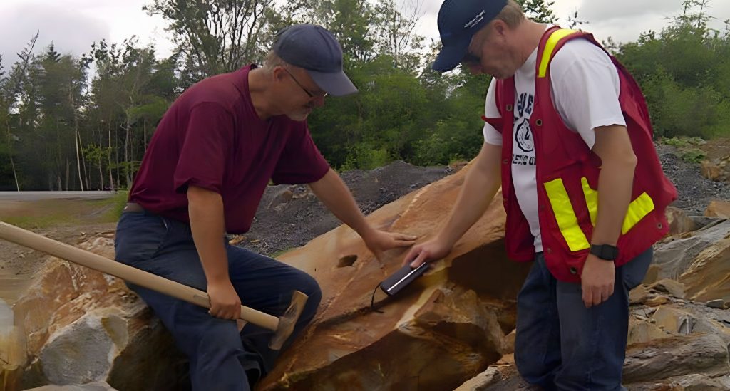
Great Atlantic Resources Corp. [TSXV: GR] provided an update on diamond drilling by HM Exploration Corp. at Great Atlantic’s Pilley’s Island Project at Pilley’s Island, north-central Newfoundland.
HM Exploration Corp. holds an option to earn a 100% interest in the project. HM Exploration Corp. has provided an update for the first five drill holes completed this year at the project. HM Exploration refers to their project area as the Lewis Pilley’s Project. HM Exploration states the first five holes of the maiden drilling program represent 1,088 metres of a planned minimum 2,500 metres of diamond drilling. These five holes were all drilled within the area of Great Atlantic’s Pilley’s Island Project.
“We are very pleased to see HM Exploration advancing the Pilley’s Island Project with a disciplined and well-executed maiden drill program,” stated Chris Anderson, CEO of Great Atlantic Resources Corp. “The early visual observations reported by HM Exploration are encouraging, particularly as they support the geological model being tested at the Clifford Jones area. We appreciate the technical work, commitment and professionalism that HM Exploration is bringing to the project, and we look forward to the receipt of assay results and further updates as exploration progresses.”
Highlights of this drilling as stated by HM Exploration include: Three of the first five drill holes intersected massive, semi-massive and disseminated sulphide mineralization.
Copper-bearing sulphide-clast debris flow mineralization successfully intersected in drilling, confirming the targeted geological model.
Angular chalcopyrite-bearing clasts observed in multiple holes, potentially indicating limited transport from source and proximity to a hydrothermal vent environment.
Multiple mineralized intervals encountered, including 6.27 metres in PI-26-001, 8.00 metres in PI-26-002 and 6.98 metres in PI-26-005.
Assays pending; HM looks forward to providing updates as drilling continues.
“The goal of our first drill program is to test the VMS-style debris flow mineralization visible at surface,” said Nick Rodway, CEO of HM Exploration Corp. “Three of the first five holes successfully intersected zones of massive, semi-massive and fine-grained disseminated sulphide mineralization, including sizeable angular chalcopyrite-bearing clasts. Surface grab samples from this area have returned values of over 16% copper, and we are encouraged to see similar mineralization now intersected in drilling. The angular nature of the mineralized clasts may indicate relatively limited transport from their source and is consistent with proximity to a hydrothermal vent environment.”
As stated by HM Exploration, drilling was focused on evaluating the continuity of the mineralized system below known surface showings and along strike of Clifford Jones Zone to improve HM Exploration’s understanding of the geological controls on mineralization. Visual observations from the initial five holes indicate that the targeted copper-bearing debris flow was successfully intersected, with zones of alteration and massive to semi-massive sulphide mineralization observed in the drill core. Core samples for the first five holes have been submitted to the laboratory for analysis. Assay results will be released once they have been returned to HM Exploration.
HM Exploration states that three of five holes intersected a wide range of massive, semi-massive and disseminated sulphide mineralization over the following drill core lengths.
PI-26-001: From 10.74 – 16.56 metres downhole; 5.82 metres drilled length; from 51.48 – 57.75 metres downhole; 6.27 metres drilled length.
PI-26-002: From 10.00 – 18.00 metres downhole; 8.00 metres drilled length.
PI-26-005: From 14.00 – 18.00 metres downhole; 4.00 metres drilled length; from 34.04 – 41.02 metres downhole; 6.98 metres drilled length.
HM Exploration states that mineralization can be described as clast-dominated debris zones consisting of sub-angular to angular fragments of massive sulphide (~85% of intercept) composed of Cpy + Py ± Sph ± Gn suspended in interstitial fine-grained disseminated sulphides (Py + Cpy ± Sph ± Gn) and milled felsic ± mafic rock. Matrix-dominated debris flow composed of fragments of sub-rounded to angular clasts of massive sulphide (Py + Cpy ± Sph ± Gn) and felsic ± mafic lithic fragments suspended in a matrix of fine-grained sulphide (Py + Cpy ± Sph ± Gn) and milled felsic ± mafic rock.
The property is located within the Notre Dame Subzone of the Dunnage Tectonostratigraphic Zone. Of note, most of the property is underlain by Ordovician submarine volcanic rocks of the Roberts Arm Group which is regionally identified as part of a mature arc sequence referred to as the Buchans-Roberts Arm Belt that also hosts the historic Buchans mine.
Mineralization occurs as lower grade (Spencer’s Dock); medium grade (Old Mines); and high grade (3B-Zone/Clifford Jones) deposits that are of both sub-seafloor replacement and exhalative varieties. The deposits are often flanked by extensive chlorite, sericite, silica, K-feldspar and epidote alteration often observed in bimodal-felsic VMS systems. The Spencer’s Dock area displays sericite/silica alteration that generally increases in intensity near mineralized zones, while the 3B/Old Mine areas display sericite/silica alteration that is abundant but less widespread and is more intense when proximal to mineralized zones.
VMS deposits are a globally significant source of copper, zinc, lead, silver, and gold. The property’s geology shares key characteristics with known Volcanogenic Massive Sulphide (VMS) districts in Newfoundland, including the past producing Buchans, Ming and Rambler Mines, supporting the exploration potential of the property.
The Lewis Pilley’s Project is road accessible and situated approximately 25 km east of the town of Springdale, approximately 55 km southeast of Firefly Metals’ Green Bay Project and approximately 150 km from the Pine Cove Mill and Port by way of major roads.
The property has a long history of mining and exploration dating back to the late 1800s when the Pilley’s Island Pyrite Company Ltd. produced approximately 450,000 tonnes of massive pyritic ore from the Pilley’s Island Mine-Old Mines.
The property hosts a cluster of VMS systems and prospects with demonstrated high-grade Zn-Pb-Cu-Ag+/-Au intersections. Mineralization is typical bimodal-felsic VMS, with both massive sulphide and sulphide-clast breccias. The geological setting is directly analogous to the Buchans camp and the presence of sulphide-clast breccias is a strong vector toward proximal massive sulphide lenses.
Most of the historic showings that fall within the extents of the property have not seen systematic exploration. Many of the historic drill holes were shallow and drilled in a vertical orientation limiting the geological knowledge of the extents of the underlying lithology and mineralization.
Work is being planned to validate historic assay results as well as collect new data from the 3B-Zone, Clifford Jones (Bull Road) Extension, Bouzanne Shaft, Henderson, Mansfield and Pilley’s Cove Showings.
Resource World Magazine Inc. has prepared this editorial for general information purposes only and should not be considered a solicitation to buy or sell securities in the companies discussed herein. The information provided has been derived from sources believed to be reliable but cannot be guaranteed. This editorial does not take into account the readers investment criteria, investment expertise, financial condition, or financial goals of individual recipients and other concerns such as jurisdictional and/or legal restrictions that may exist for certain persons. Recipients should rely on their own due diligence and seek their own professional advice before investing.