
Tudor Gold drills 9.5 metres of 9.00 g/t gold at Treaty Creek Project, British Columbia
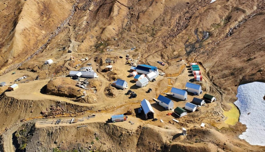
Tudor Gold Corp. [TSXV: TUD; FSE: H56] released results from four holes drilled at the Perfectstorm zone at its 80%-owned Treaty Creek Project in northern British Columbia’s Golden Triangle. Results from drill holes PS-26-34 and PS-26-36, which were drilled to follow-up on surface sampling completed earlier in the season, have identified a new high-grade, low-to-intermediate-sulphidation system approximately 500 metres northwest of prior drilling on the Perfectstorm copper-gold porphyry system.
Additionally, drill hole PS-26-35 intersected a continuance of gold-dominant mineralization at depth within the PSP zone system identified to date. Perfectstorm’s PSP zone has now been extended downdip and along strike and remains open.
The 2026 Treaty Creek exploration program has been completed, with crews currently demobilizing from site. The 2026 program consisted of 22,511 metres of drilling in 44 holes and was successful in discovering a new porphyry system, the PSP zone, and multiple zones of epithermal gold mineralization at the Perfectstorm zone. The PSP zone has been defined by 23 holes announced to date, with a further 19 holes in the queue for assaying at the lab. A maiden mineral resource estimate is expected to be prepared for the PSP zone once all assays have been received from the 2026 program.
Drilling highlights: Hole PS-26-34 intersected 2.25 g/t gold and 3.10 g/t silver over 37.50 metres starting 127.50 metres downhole, including 5.25 g/t gold and 6.93 g/t silver over 10.50 metres starting 130.50 metres downhole, including 10.17 g/t gold and 11.85 g/t silver over 4.50 metres starting 136.50 metres downhole.
Hole PS-26-36 intersected 0.80 g/t gold and 713.91 g/t silver over 4.20 metres starting 45.00 metres downhole; 9.00 g/t gold and 9.66 g/t silver over 9.50 metres starting 163.50 metres downhole, including 22.29 g/t gold and 21.52 g/t silver over 3.62 metres starting 165.30 metres downhole, including 43.29 g/t gold and 16.90 g/t silver over 1.20 metres starting 166.50 metres downhole.
Hole PS-26-35 intersected 1.77 g/t gold and 2.31 g/t silver over 21.60 metres starting 366.00 metres downhole, including 6.89 g/t gold and 5.86 g/t silver over 3.55 metres starting 367.50 metres downhole; 0.93 g/t gold and 3.40 g/t silver over 49.80 metres starting 1,042.95 metres downhole, including 2.34 g/t gold and 10.16 g/t silver over 3.90 metres starting 1,072.00 metres downhole.
Surface prospecting and sampling completed at the Perfectstorm zone throughout the 2026 program identified a strongly mineralized vein and breccia system approximately 25 metres in width at surface composed of multiple mineralized structures containing abundant chalcopyrite and galena
Four of the surface samples returned significant gold and silver values of up to 12.90 g/t gold and up to 444 g/t silver, indicating a precious-metal-rich structural system. Drill holes PS-26-34 and PS-26-36 were targeted at testing the downdip extension of this surface zone.
As highlighted above, PS-26-34 cut 10.17 g/t gold and 11.85 g/t silver over 4.50 metres, 190 metres downdip of the surface expression. PS-26-36 cut both high-grade gold and silver intervals extending the mineralized zone along a strike length of 125 metres. Two subsequent drill holes, PS-26-37 and PS-26-38 have assays pending with intercepts through this zone.
Additional prospecting in the area has returned surface sample results indicating the possibility of multiple high-grade gold and silver mineralized structures throughout the area. Another north-south-trending structure occurring 210 metres to the east was identified with results of up to 35.66 g/t gold indicating the possibility of multiple stacked subvertical structures.
Drill hole PS-26-35 intersected a continuance of gold-dominant mineralization at depth within the PSP zone system. The drill hole has extended the mineralized footprint by 220 metres at depth from PS-26-21, which intersected 0.85 g/t gold and 4.09 g/t silver over 34.50 metres, including 1.68 g/t gold and 8.77 g/t silver over 7.50 metres, adding significant volume to the mineralized system, while demonstrating consistent, broad, gold-dominant intercepts.
The PSP zone is located approximately one kilometre southwest of Treaty Creek’s Goldstorm deposit at its closest point and approximately 4 km northeast of Seabridge Gold’s Iron Cap deposit, along the northeast-southwest-trending Sulphurets corridor that hosts multiple porphyry deposits and prospects. The system remains open in all directions. Treaty Creek’s Goldstorm deposit, as disclosed in the “NI 43-101 Technical Report, Treaty Creek Project, British Columbia,” dated Nov. 30, 2025, and prepared by Garth Kirkham, PGeo, of Kirkham Geosystems and Renee Goold (Morrison), PEng, of Fuse Advisors, hosts indicated mineral resources of 24.9 million ounces of gold, 148.7 million ounces of silver and 3,048 million pounds of copper (912.3 million tonnes grading 0.85 g/t gold, 5.07 g/t silver and 0.15 per cent copper) and inferred mineral resources of 2.6 million ounces of gold, 7.2 million ounces of silver and 67.9 million pounds of copper (21.8 million tonnes grading 3.64 g/t gold, 10.22 g/t silver and 0.14 per cent copper).
The Goldstorm deposit remains open in all directions, and a permit application has been filed for approval to construct an underground ramp for access to drill the high-grade gold SC-1 zone. A preliminary economic assessment on placing the Goldstorm deposit in production as an underground mine is now under way. In addition to the Goldstorm deposit, Treaty Creek hosts other gold discoveries nearby: the CBS, Eureka and Perfectstorm zones.
Tudor Gold is a precious and base metals exploration and development company with claims in British Columbia’s Golden Triangle, an area that hosts producing and past-producing mines and several large deposits that are approaching potential development. The 17,913-hectare Treaty Creek project (in which Tudor Gold has an 80% interest) borders Seabridge Gold’s KSM property to the southwest and borders Newmont Corp.’s Brucejack mine property to the southeast.
Resource World Magazine Inc. has prepared this editorial for general information purposes only and should not be considered a solicitation to buy or sell securities in the companies discussed herein. The information provided has been derived from sources believed to be reliable but cannot be guaranteed. This editorial does not take into account the readers investment criteria, investment expertise, financial condition, or financial goals of individual recipients and other concerns such as jurisdictional and/or legal restrictions that may exist for certain persons. Recipients should rely on their own due diligence and seek their own professional advice before investing.