
Westward Gold updates exploration at Toiyabe Hills, Nevada
Westward Gold Inc. [CSE-WG; OTCQB-WGLIF; FSE-IM50] provided an update on 2024 exploration activities at its flagship Toiyabe Hills consolidated land package, situated along the Cortez Trend in Lander County, Nevada.
The primary goal of the programs – designed by Westward’s technical team with a history of significant Carlin-type gold discoveries to their credit – is to define new high-priority drill targets on the company’s 55 km2 property.
The highlights of ongoing and upcoming field programs are as follows: 1:5000 district-scale, Anaconda-style geological mapping continues, led by Vice President Exploration Robert Edie and Technical Advisor Steven Koehler.
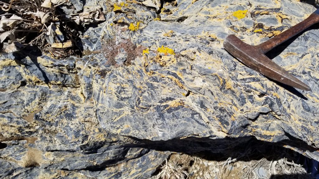
A rock-chip sampling program is ongoing, focused on areas of interest identified during mapping; to date, 143 samples have been submitted for assays, and collection will continue throughout the season
Collection of soil samples began in July, across a grid designed to fill in data on previously-unsampled ground, notably, the newly-acquired East Saddle Extension Claims.
Engaged MWH Geo-Surveys International Inc. to conduct a gravity survey across the entire property, improving upon inherited data with tighter station spacings; program will commence in early August
Following completion of the programs outlined above, Westward’s technical team will consolidate and analyze all available data to rank drill targets using both a proprietary scoring system, and their personal experience working on Carlin-type gold systems.
Westward Strategic Advisor Kelly Cluer recently returned from a site visit to Toiyabe Hills and noted the following: “Having completed structural transects across this large, consolidated land package, the district-scale opportunities now available to the company become readily apparent. From the known gold mineralization at Toiyabe on our west flank – adjacent to a past-producing open-pit mine – across to the central and eastern sectors, there is a repetition of both structure and stratigraphy.
“Indications are that the previously-identified “Hilltop Corridor” is a feature with scale that is significantly underexplored, with mapped large displacement structures near the axis of an antiform, gold and arsenic geochemical anomalies, multi-phase igneous dikes including lamprophyre, and lower-plate strata at manageable drilling depths. I’m very confident that the systematic field work currently being undertaken will yield several high-quality targets in the near future. This is emblematic of the opportunity that can be created in Nevada, practically in the shadow of large long-lived gold camps, with strategic land acquisition and discovery-oriented exploration tactics.”
To date, 1:5000 Anaconda-style geological mapping has covered approximately 9 km2, building upon previous mapping campaigns that were focused on the original Toiyabe claims block. With the benefit of Westward’s successful land consolidation since that time, the current program has moved eastward and southward, with the intention of covering the entire land position.
So far, the company has identified three new, large alteration zones in upper- and lower-plate rocks which exhibit geological characteristics consistent with many Carlin-type gold deposits in the area. These include dike-filled fault corridors (dike swarms), multiple igneous rock types, repeating sections of favourable stratigraphy, multiple compressional tectonic events, and exposures of punky-decalcified and oxidized limestone. The vast majority of Toiyabe Hills (including the Turquoise Canyon, East Saddle and East Saddle Extension claim blocks) remains untested with drilling.
Westward geologists have collected 143 surface rock-chip samples for analysis, largely focused around the aforementioned alteration zones. These samples are characterized by alteration assemblages consistent with known Carlin-type gold deposits in the region, and include oxidized-decalcified-locally silicified silty limestone of the Wenban Formation, oxidized-sulfidized-clay altered igneous dikes, and quartz-barite veined siliciclastics of the Vinini Formation. Samples have been submitted for gold and multi-element analysis to further enhance the company’s drill target definition, and additional sample collection will continue throughout the remainder of the field season.
A gravity survey with 200-meter station spacing will be conducted in August. Tightly-spaced gravity surveys deliver powerful data in the exploration of Carlin-type gold systems, particularly as a tool for mapping the subsurface location of mineralization-controlling faults, fractures and alteration zones. This will provide another cost-effective targeting tool, narrowing search areas to those most prospective for gold deposition.
Westward Gold is a mineral exploration company focused on developing the Toiyabe Hills Project located in the Cortez Hills area of Lander County, Nevada, and the Coyote and Rossi Projects located along the Carlin Trend in Elko County, Nevada.