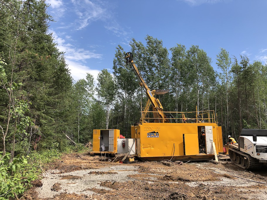
Galleon Gold drills 5.53 g/t gold over 12.5 metres at West Cache, Ontario

Galleon Gold Corp. [GGO-TSXV] reported assay results from its 2022/2023 exploration and geomechanical drill programs at its 100%-owned flagship West Cache gold project in the prolific Timmins gold belt near Timmins, northeastern Ontario.
Drilling highlights: Geomechanical hole WC-22-219A intersected 5.53 g/t gold over 12.5 metres in Zone No. 9, including 9.97 g/t gold over five metres. Hole WC-22-131EX in South zone intersected 8.76 g/t gold over 1.8 metres. Hole WC-22-216 in South zone intersected 2.3 g/t gold over 5.5 metres. Hole WC-22-214 in South zone intersected 3.2 g/t gold over 3.2 metres.
David Russell, president and CEO, commented: “Today’s results continue to confirm the impressive grade continuity of Zone No. 9, while also highlighting the growing importance of the nearby South area mineralized zones. Our focus over the next several months will be on permitting and preparation for the Zone No. 9 bulk sample. In addition, exploration programs to help delineate the resource potential of the South area will be designed using both surface and underground drill programs.”
The company completed 3,527 metres of NQ drilling in eight exploration drill holes and/or drill hole extensions to better define multiple gold-bearing zones located 300 metres south of Zone No. 9 and only 100 metres south of planned development ramps.
There are two predominant mineralized horizons emerging in the South area felsic metavolcanic unit, the Upper South zones just below the contact with metasediments and the Lower South zones nearer the metavolcanic unit’s lower contact with metasediments. The upper zones dip 55 degrees to the north like Zone No. 9, while the lower zones dip 80 degrees to vertical.
Upper South zone: WC-22-131EX tested the South Area along strike 100 metres west of the 2020 discovery holes and intersected several mineralized horizons, including 8.76 g/t gold over 1.8 metres. This interval includes both pyrite-sphalerite-chalcopyrite mineralization and quartz-carbonate-tourmaline veining: 3.20 g/t gold over 3.2 metres in WC-22-214 with up to 15% semi-massive pyrite located 35-metres due south of the bulk sample decline; 1.16 g/t gold over 3.5 metres in WC-22-218 with up to 25% sulphide (pyrite-sphalerite-chalcopyrite); 1.07 g/t gold over 6.3 metres in WC-22-174EX, including 3.05 g/t gold over 1.0 metre located 25-metres south of the bulk sample development ramp.
Lower South Zone: WC-22-215 with 2.85 g/t gold over 35.2 metres, including 79.2 g/t gold over 0.7 metres, recently underwent multi-element analysis and this zone returned 140 g/t silver in the 79.2 g/t gold sample within semi-massive to massive sulphide mineralization. This intercept is 50 metres up-dip from WC-20-077 (2020 drill hole) with 1.03 g/t gold over 41.5 metres, including 2.63 g/t gold over 7.5 metres. Hole WC-22-216 intersected 2.30 g/t gold over 5.5 metres, including 6.39 g/t gold over 1.5 metres 25-metres west of the -215 intercept in the lower zones. Broad intercepts of elevated gold have been intersected in the lower zones over 180 metres of dip extent.
The South Area’s proximity to the bulk sample planned workings provides an opportunity to better define the deeper gold zones with future underground drilling, while surface drilling will target up-dip extensions known from previous drilling to “daylight” at the bedrock interface.
In late 2022, Galleon Gold completed 876 metres of HQ3 geomechanical drilling in eight holes and commenced overburden (till) drilling and test pit sampling – all in support of the Zone #9 bulk sample facilities and underground access detail design. Geomechanical hole WC-22-219A intersected Zone #9 and returned 9.97 g/t gold over 5.0 metres within a broader zone of 5.53 g/t gold over 12.5 metres.
The West Cache Gold Project is an advanced-stage gold exploration project covering approximately 10,370 hectares 13 km west of Timmins on Provincial Highway 101. It is situated in the Western Porcupine Gold Camp along the Destor-Porcupine Fault Zone within the Abitibi greenstone belt, approximately 7 km northeast of Pan American Silver’s Timmins West Mine. The mining lease area hosts the current mineral resource estimate near the center, with additional exploration targets to the north and south. The mineral resource estimate is contained within the Porcupine Sedimentary Basin, a favourable litho-structural corridor with over 5 km of strike-length on the Property. Mineralization is open in all directions and at depth.
A 2022 Preliminary Economic Assessment (PEA) for the project demonstrates strong economics. Detail engineering design and baseline studies in support of a permit application for an underground bulk sample are underway.
