
Skyharbour conducts survey for Russell Lake drilling, Saskatchewan
Skyharbour Resources Ltd. [TSXV; SYH; OTCQX: SYHBF; FSE: SC1P] has carried out an ambient noise tomography survey prior to the coming fall drill program and has received the remaining results from the second phase of the program earlier this year at the 73,294-hectare Russell Lake uranium project, Athabasca basin, Saskatchewan.
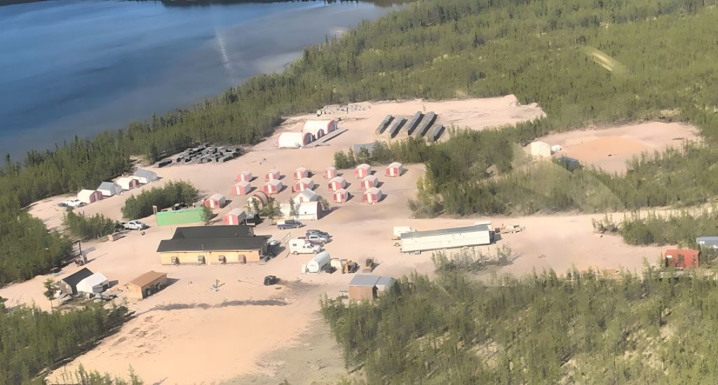
The project is 51%-owned by Skyharbour as operator, with joint venture partner Rio Tinto Exploration Canada Inc. owning 49%. It is strategically located in the central core of the eastern Athabasca basin of northern Saskatchewan adjacent to regional infrastructure, including an all-weather road and power line, allowing for drilling throughout all seasons.
ANT survey and fall drill campaign: In preparation for the coming drill program at Russell, Skyharbour has completed an ambient noise tomography survey at the Russell Lake project. The survey used Fleet Space Technologies’ ExoSphere technology to acquire 3-D passive seismic velocity data over the highly prospective Grayling and Fork target areas, where previous drilling has intersected high-grade uranium mineralization. The ANT technology has been employed in mapping significant sandstone and basement structures and associated alteration zones related to hydrothermal fluids pathways in the Athabasca basin.
The results from this survey will be used to further refine drill targets for the fall 2024 drill program at Russell. Skyharbour is fully financed and permitted for the follow-up fall drill campaign consisting of approximately 7,000 metres of drilling at its main Russell and Moore projects, with 2,500 metres of drilling at Moore and 4,500 metres of drilling at Russell.
Drilling at Russell earlier this year was completed during two separate phases of drilling, with a total of 5,152 metres drilled in 10 holes during the winter and spring of 2024. The first phase of drilling consisted of a total of 3,094 metres in six holes, which were previously reported, while the second phase of drilling consisted of 2,058 metres of drilling in four holes.
During phase 1, the best intercept of uranium mineralization to date on the property was intersected in RSL24-02, which returned a 2.5-metre-wide intercept of 0.721% triuranium octoxide at a relatively shallow depth of 338.1 metres, including 2.99% U3O8 over 0.5 metre at 339.6 metres, just above the unconformity in the sandstone. The mineralization is open in all directions and will be a focus of coming drilling. Phase 2 drilling at the MZE (M-zone extension) target, approximately 10 km northeast of the Fork target, identified prospective faulted graphitic gneiss accompanied by anomalous sandstone and basement geochemistry. All processing of the core has been completed, and geochemical results have been obtained for all drill holes.
Phase 1 winter drilling at Russell: The first phase of drilling focused on drill testing the newly identified Fork target area related to and south-southwest of the Grayling zone. One hole during phase 1 was drilled to test an East Grayling target, approximately 3 km to the southeast of the Fork target area.
The highlight of the drilling in phase 1 was hole RSL24-02, which tested a separate northeast- to east-trending conductor at the Fork target area and intersected significant mineralization in the sandstone near the unconformity. The hole returned 0.721% U3O8 over 2.5 metres between a 338.1- and 340.3-metre depth, including 2.99% U3O8 over 0.5 metre between 399.6 and 340.6 metres.
Mineralization is open in all directions. The basement rocks consisted of strongly graphitic pelitic gneisses accompanied by pegmatite, calc-silicate, and locally radioactive chloritized graphitic shears and fault zones throughout. The mineralized zone in RSL24-02 was highly enriched in lead, zinc and other pathfinder elements, while local graphitic faults throughout the basement rocks intersected strongly anomalous vanadium, zinc, nickel and copper.
As previously reported, follow-up drilling both downdip and 175 metres along strike to the west of RSL24-02 in holes RSL24-04 and 05 intersected prospective sandstone and basement geology and significant uranium and pathfinder geochemistry. Hole RSL24-04 deviated significantly and missed the intended target.
The Russell Lake project is a large, advanced-stage uranium exploration property totalling 73,294 hectares strategically located between Cameco’s Key Lake and McArthur River projects and adjoining Denison’s Wheeler River project to the west and Skyharbour’s Moore uranium project to the east. The northern extension of Highway 914 between Key Lake and McArthur River runs through the western extent of the property and greatly enhances accessibility, while a high-voltage power line is situated alongside this road and the western edge of the property south of Key Lake. Skyharbour’s acquisition of Russell Lake creates a large, nearly contiguous block of highly prospective uranium claims totalling 108,999 hectares between the Russell Lake and the Moore uranium projects.
Skyharbour holds an extensive portfolio of uranium exploration projects in Canada’s Athabasca basin and is well positioned to benefit from improving uranium market fundamentals with 29 projects, 10 of which are drill-ready, covering over 580,000 hectares (over 1.4 million acres) of land.