
Westward Gold details exploration plans for Toiyabe Hills Project, Cortez Trend, Nevada
Westward Gold Inc. [CSE: WG; OTCQB: WGLIF; FSE: IM50] outlined plans for the 2025 exploration season at its 100%-owned, flagship Toiyabe Hills property situated along Nevada’s Cortez Trend.
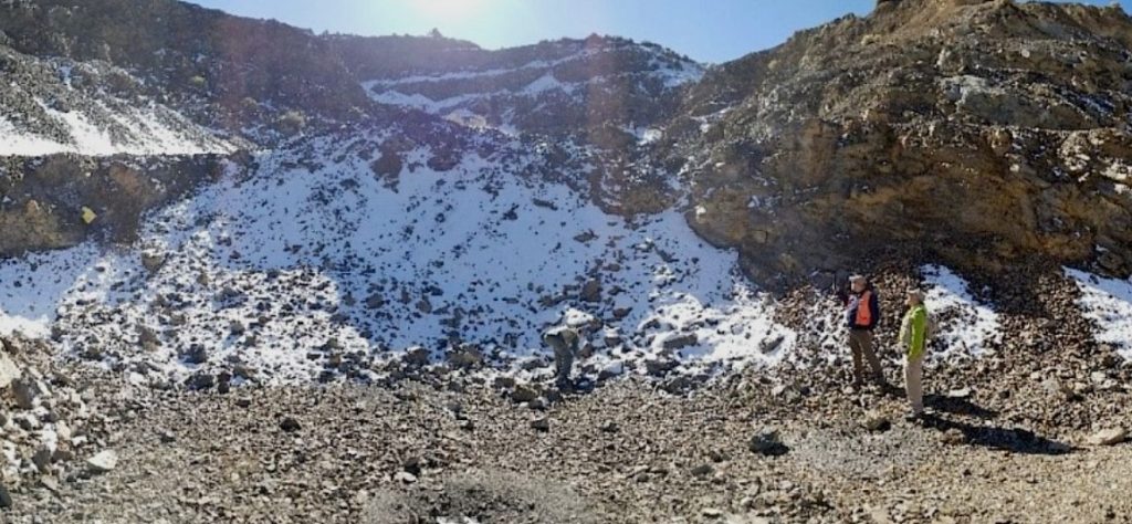
Toiyabe Hills is a +60 km2 land package comprised of 737 contiguous, unpatented mining claims administered by the U.S. Bureau of Land Management (BLM). Multiple targets within the Campfire Target Complex have been identified, de-risked and are primed for drilling under a Phase 1 program.
The 2025 program objectives are: at Campfire, complete up to 5,000 metres of reverse circulation (RC ) drilling across approximately 10 holes starting in late Q2/early Q3, to test new, high-value greenfield targets; expand the soil and rock-chip geochemistry and gravity coverage on recently-acquired ground; and expand the 1:5000 scale Anaconda-style geological mapping and surface sampling with a focus on developing new drill targets in the footwall of a district-scale, mantle-tapping structural corridor (the Hilltop Corridor).
Kelly Cluer, Director, noted: “The information gleaned from our systematic 2024 programs has revealed new and compelling large-scale features that had been overlooked in the decades preceding the consolidation of this ground, and has elevated Campfire to must-drill status. This intersection of previously independent claim blocks contains a substantial gravity alteration cell developed in lower-plate carbonate rocks, in the immediate footwall of the Hilltop Corridor, a massive north-south structural corridor that runs the entire extent of the Property. We’ve also identified lamprophyre dikes within the Hilltop Corridor, marking a compelling crustal crack. The structural setting of this target is reminiscent of the many significant discoveries made in the footwall of the Post Fault on the Carlin Trend.”
Key Highlights for 2025: At Campfire, Phase 1 drilling will test up-plunge and down-plunge stratigraphic and structural targets developed in the Campfire Anticline. An estimated 10 holes, with collar spacings of approximately 500 meters, will be drilled using an RC rig rated to a maximum depth capacity of 3,000 feet (~915 metres).
RC drilling is a cost-effective technique commonly used in Nevada to establish proof of concept in greenfield targets, and will identify anomalous Carlin-type mineralization, major stratigraphy, and hydrothermal alteration. This maiden drill program is designed to inform and guide a follow-up Phase 2 campaign.
Estimated depth to favourable lower-plate carbonate rocks will vary, with near-surface targets up-plunge along the Campfire Anticline and deeper targets over the nexus of geophysical anomalies further north-east.
The company is estimating an all-in budget of approximately US$2 million for this program, from earthwork to assays, and is currently evaluating proposals from over 20 contractors and service providers.
The company will expand soil and rock-chip geochemistry and gravity coverage over its recently-acquired ground.
In combination with detailed geological mapping, these are the most cost-effective surface programs available in the hunt for Carlin-type gold deposits.
At the Hilltop Corridor, the company will expand the 1:5000 scale Anaconda-style geological mapping and surface sampling with a focus on advancing a pipeline of new drill targets in the footwall of this north-trending structural corridor.
Gravity and initial field reconnaissance confirms this structural feature is a major control on Carlin-type alteration and igneous dikes, namely lamprophyres.
Westward believes that additional mapping along strike will continue to identify new, previously-unrecognized target opportunities in footwall rocks.
Following a 2024 exploration campaign focused on district-scale, systematic, and multi-disciplinary exploration programs, the data conclusively pointed the company’s technical team towards the compelling greenfield opportunity that is the Campfire Target Complex. The layering of independent datasets – geology, geophysics, and geochemistry – continued to solidify the thesis of a potential gold feeder zone and Campfire’s status as Westward’s top priority:
Geology: 1:5000 Anaconda-style geological mapping identified a northeast-plunging, dike-filled anticline, developed in lower-plate carbonate rocks and plunging directly to the nexus of gravity and ZTEM-imaged alteration features.
Geophysics: The confluence of a large gravity alteration cell developed in lower-plate carbonate rocks, a pronounced circular resistivity low at 200 metres elevation, transitioning to a circular resistivity high at 1,700 metres elevation – identified through ZTEM and suggestive of a sulfidic breccia pipe-like body, and a deep-seated intrusive interpreted through RTP magnetics; all in the footwall of the Hilltop Corridor – a lamprophyre-filled north-south trending structural corridor spanning the entire Property.
Geochemistry: A distinct gold-arsenic geochemical plume, mapped by extensive soil grid and rock sample surveys, is developed along the west and south margins (up-plunge) of the circular geophysical features – as expected for a main-stage fluid conduit in Carlin-type gold systems. Near-surface gold mineralization at the Courtney Zone and adjacent past-producing Toiyabe-Saddle Mine is interpreted as higher-grade gold deposition within the geochemical plume.
Westward Gold is developing the Toiyabe Hills Project located in the Cortez Hills area, Lander County, Nevada, and the Coyote and Rossi Projects along the Carlin Trend, Elko County, Nevada.