
Nevada Sunrise posts soil sampling results at Fivemile Gold Project, Cortez Mining District, Nevada
Nevada Sunrise Metals Corp. [TSXV: NEV; OTC Pink: NVSGF] reported results of an Ionic LeachTM soil survey program at the Fivemile Gold Project, located within the Battle Mountain-Eureka-Cortez gold trend in Lander County, Nevada.
The property is located approximately 4 miles (6.4 km) south-southwest of the Cortez Hills mine and 5 miles (8 km) southwest of the Goldrush mine, both operated by Nevada Gold Mines LLC (NGM), a joint venture between Barrick Mining Corp. [TSX: ABX; NYSE: B] (61.5%) and Newmont Mining Corp. (38.5%). Fivemile lies 6 miles (10 km) southwest of the Fourmile gold deposit owned 100% by Barrick, which is planned to be contributed by Barrick into NGM.
“The results of our inaugural exploration program at Fivemile represent just the first layer of modern exploration data acquired by the company at the Project,” said Warren Stanyer, President and CEO of Nevada Sunrise. “The presence of anomalous gold-in-soils and other important pathfinder minerals detected from the use of a unique geochemical method is a gratifying result in an environment with little-to-no surface expression as we begin the search for a buried gold deposit at Fivemile.”
Fivemile Soil Survey: Three hundred (300) soil samples were collected property-wide at 150-metre intervals on northeast trending lines spaced 600 metres apart, and were delivered to ALS Global Laboratories in Reno, Nevada, for analysis by their proprietary Ionic LeachTM method, which can detect minute traces of deeply-buried mineral deposits in surface soils.
The results of the survey show areas at Fivemile anomalous in gold, arsenic, copper, and selenium. In the northern part of the Property, a classic geochemical halo anomaly is present with an aureole of higher values surrounding a core of lower values. This well-developed “doughnut-hole” negative anomaly, or depletion halo, lies over the coincident geophysical anomalies that were previously identified from re-processing United State Geological Survey public-domain data.
Depletion haloes are recognized by geoscientists as an important indication of a mineralizing process that may have caused both the depletion halo and a ring of higher values away from the presumed source. Further, groundwater transport of metals ions is interpreted to have weakened the high value anomalies in the vicinity of the doughnut hole and caused a strong “apron” soil anomaly down-gradient in the playa lake bed in the southern area of the property.
This groundwater flow at the property is evidenced by the presence of ephemeral springs, i.e., an intermittent expression of surface water (the Fivemile Springs), which breach the surface approximately one mile (1.6 km) south of the geophysical anomalies in the northern part of the property. The lateral transport of metals ions by groundwater from their presumed source is described in geoscientific literature over the last three decades since the implementation of partial leach soil geochemical surveys in the modern era of mineral exploration.
As the next step in developing drill targets at Fivemile, the company is soliciting bids from geophysical contractors for a high-resolution ground gravity survey to better define the conjunction of the gravity high with the magnetic low identified from the regional USGS geophysical surveys. The gravity survey is expected to commence in the fourth quarter 2026.
Ionic LeachTM soil surveys are known to be effective to detect areas anomalous for gold and other Carlin-type gold deposit pathfinder elements. Case studies of the Ionic LeachTM soil sampling method have been successful in detecting buried mineralization, particularly in challenging environments with cover, as seen at the Pebble copper-gold-molybdenum deposit in Alaska, and the Sams Creek Project in New Zealand.
These case studies demonstrate that the Ionic LeachTM method is effective for identifying “blind” mineralization, even through thick cover, by extracting the mobile, loosely-bound metal ions present in soil and sediment.
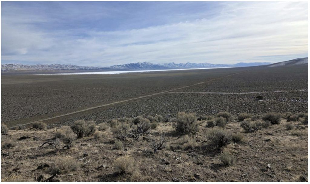
Fivemile consists of 292 unpatented mineral claims on Bureau of Land Management land totaling approximately 6,033 acres (2,442 ha). The majority of the Fivemile claims, staked in 2025 and 2026, cover an area of alluvium-covered shallow pediment, referred to by the company as Fivemile Flats which has no outcrop, thus inhibiting previous surface exploration.
The exploration targets at Fivemile are two-fold: epithermal gold/silver mineralization related to the Caetano Caldera, possibly superimposed on an earlier Carlin-type gold deposit(s), similar to the Fourmile, Goldrush and Cortez Hills gold deposits.
The Fivemile primary gold exploration targets were generated by reprocessing publicly-available data collected by the USGS and integrating that data with a proprietary geological interpretation of structural features that are visible in the geophysical, geological and satellite imagery data. The geophysical signature of Fivemile is observed as the conjunction of a gravity high anomaly and a magnetic low anomaly. The gravity high at Fivemile mirrors a gravity high associated with the Fourmile and Goldrush deposits located to the northeast of the Property.
Fivemile also lies in the same relative position as the Fourmile and Goldrush deposits, which are located along the western border of a larger Eocene-Miocene apical graben in the core of a larger NNW-SSE trending regional anticline. The center of this apical graben localized the Northern Nevada Rift zone in mid-Miocene time. Miocene lake sediments were deposited in this graben.
From the available geophysical and geological data, the company has inferred regional NE-SW trending faults that pass through the Fourmile-Goldrush and the historical Toiyabe Mine areas, and the Fivemile property area. These faults, herein referred to as the Fourmile Faults, are believed to have been active in Eocene through Miocene time and controlled gold mineralization at interpreted intersections with N-S trending graben normal faults. In the Fivemile area, the Fourmile faults probably localized part of the Caetano Caldera ring-fracture system and also intersected and offset N-S Cortez graben faults in the vicinity of the geophysical anomalies.
Nevada Sunrise can earn a 79% interest in Fivemile from American Metals Exploration Corp., a private Nevada company at arm’s-length to Nevada Sunrise, in three stages over 4 years from the effective date of the earn-in option agreement.
The ALS Ionic Leach™ process provides a package of 61 elements analyzed by an inductively coupled plasma mass spectrometry (ICP-MS) instrument. The Ionic Leach™ analytical method achieves extremely low sub-ppb (below pars per billion) detection limits, allowing for the detection of “natural background” levels of elements, which is crucial for identifying subtle anomalies.
Management cautions that published any historical results were collected and reported by operators unrelated to Nevada Sunrise and have not been verified nor confirmed by its Qualified Person; however, the historical results create a scientific basis for ongoing work at the Fivemile.
Nevada Sunrise holds the right to purchase a 100% interest in the Griffon Gold Mine Project, located approximately 50 km (33 miles) southwest of Ely, Nevada.
Nevada Sunrise holds the right to earn a 79% interest in the Fivemile Gold Project, located approximately 40 km (25 miles) south of Battle Mountain, Nevada.
Nevada Sunrise holds the right to earn a 100% interest in the Coronado Copper Project, located approximately 48 km (30 miles) southeast of Winnemucca, Nevada.
Nevada Sunrise owns 100% interests in the Gemini West, Jackson Wash and Badlands lithium projects, all of which are located in the Lida Valley in Esmeralda County, Nevada.
As a complement to its exploration projects in Esmeralda County, the company owns Nevada Water Right Permit 86863, also located in the Lida Valley basin, near Lida, Nevada.