
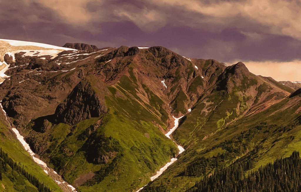
Sanatana completes exploration program at Oweegee, Golden Triangle, British Columbia
Sanatana Resources Inc. [STA-TSXV; SADMF-OTC] reported completing 3,679 metres of HQ-size core drilling in 12 holes on its Oweegee copper-gold (Cu-Au) porphyry project located in northwest British Columbia’s Golden Triangle. This marks the completion of the first porphyry-focused drill program on the Oweegee Dome project.
Peter Miles CEO, commented, “Despite inclement weather for much of the late spring and early summer our initial drill program proceeded as planned thanks to the efforts of our team at Bell 2 camp. This summer’s drilling primarily tested the boundaries of the Molloy monzonite followed by validation and extension of the known historic copper intercepts and lastly to test new targets.”
|
Miles continued, “This program was specifically designed to test the theory that there is a copper-gold porphyry system on the Oweegee Dome project, which is just 40 km east of the KSM porphyry deposits, one of the largest undeveloped Cu-Au Reserves in the world. Our geological staff and hired expert consultants, all who have extensive porphyry experience, unanimously confirmed that we are in the upper levels of a porphyry system. Future exploration will seek to locate the thermal centre of this system where the high grades should reside.” |
Out of the 12 holes drilled, copper mineralization was noted in eight. Primarily, the mineralization is hosted in a monomictic (one rock type) intrusive breccia.
A total of six holes tested the Molloy monzonite target where the company had mapped and sampled Cu-Au bearing monzonite outcrop and returned an average of 0.34% copper + 0.829 g/t gold from 15 grab samples. The first hole was located, 200 metres back from the Molloy outcrop on the nearest ridge. Drilling was directed east towards at 70 degrees bearing. It intersected a QSP (quartz, sericite, pyrite or phyllic) altered intrusive breccia in the upper 120 metres of the hole before it completed at 438 metres in rocks of the Stuhini formation (Triassic aged basement rocks), ash laden mudstones and chlorite altered green fragmental volcanics.
The next series of five holes were drilled in a spread of different bearings and dips from a single pad, constructed directly on the outcrop. Copper mineralization was observed in all five holes, hosted in a chlorite overprinted potassic to QSP altered fine grained monzonite hosted hydrothermal breccia, similar to the outcrop.
Drill hole, OW-2022-02 targeted the donut shaped IP changeability anomaly that circled the Molloy zone. It encountered disseminated pyrite hosted in a fine grained, QSP altered monzonite, that probably explains the anomaly, however target depth was not completed due to the loss of the hole.
Drill holes OW-2022-08 and -09 targeted the Delta ridge historic copper mineralization and were designed to deepen and extend this zone. Copper mineralization was observed in both holes, extending the depth and the strike.
Drill hole OW-2022-10, collared on “Pinnacle Ridge” targeted a prominent copper and gold in soil anomaly 600 metres west of the historic copper intercepts. It encountered a copper-bearing zone from 143.25 to 187.15 metres, where the chalcopyrite is seen in discrete zones hosted in a QSP altered polymictic breccia, similar to that noted in OW-2022-05.
The copper mineralization encountered at Molloy, Delta ridge and Pinnacle covers a 1.8 km2 zone and, given the similarity of host rocks and alteration, the collective area is interpreted to represent one large system, with the potassic alteration at Molloy representing a hotter more intensely altered part of the system.
The last two holes OW-2022-11 and OW-2022-12 were step-out holes to understand the possible extent of the mineral system at Delta. Drill hole 11 targeted the recently discovered copper bearing outcrop of diorite over 1,000 metres south and 500 metres lower elevation than the holes above at the Delta Ridge and Molloy zones. It encountered a QSP altered hydrothermal brecciate intrusive in the top 64 metres, that may equate to the outcrop. Drill hole 12 targeted an intense potassic altered intrusive in the Snowpatch creek eastern valley wall 1,700 metres west of the Molloy Zone. It encountered pyrite bearing breccias at the IP target depth, possibly explaining the anomaly.
Field work continues on the property with field crew concentrating on mapping and sampling the Skowill prospect, and an area of QSP altered intrusions east of Bear Creek 1 km east of the current drilling on the Delta prospect reported here. A Dias geophysical crew is conducting an IP survey over the Delta prospect area and extending and infilling to the west.