
Arizona Metals drills 4.8% CuEq over 8.8 metres at Kay mine, Arizona
Arizona Metals Corp. [AMC-TSX; AZMCF-OTCQX] has intersected a potential new zone of copper-gold-zinc volcanogenic massive sulphide mineralization at its Kay mine project, Arizona, located 600 metres north and along strike of the central target electromagnetic anomaly.
Hole KM-22-95 intersected 2.7 metres grading 0.5% CuEq (copper equivalent) at a vertical depth of approximately 320 metres. Clasts of massive sulphide mineralization have been observed in this interval, which can be indicative of proximity to primary massive sulphide mineralization. Follow-up drilling is planned to test for extensions of the mineralization encountered in this hole.
Extensional drilling located at the northern edge of the Kay mine deposit intersected 8.8 metres of 4.8% CuEq in hole KM-23-97. This hole extended mineralization by 100 metres north of hole KM-22-71A and confirmed the vertical continuity of high-grade mineralization in the 160 metres between holes KM-20-11 and KM-21-19.
The company is also pleased to report on six additional holes from the Kay mine deposit, including both infill and extensional holes.
Drilling at the western target commenced in February, 2023. The first hole is this area, KM-23-104, is currently under way and has been drilled to approximately 650 metres west of pad W1 and to a vertical depth of 700 m below surface. Upon completion of this hole, the company will undertake a down-hole electromagnetic survey to test for extensions of conductors previously observed in both helicopter and ground-loop electromagnetic testing.
Arizona Metals is fully financed (with $53-million in cash at December 31, 2022) to complete the remaining 3,800 metres planned for the phase 2 program at the Kay mine deposit (budgeted at $1.6-million) as well as an additional 76,000 metres in the phase 3 program (budgeted at $32-million), which will be used to test the numerous parallel targets heading west of the Kay mine deposit, as well as possible northern and southern extensions.
Marc Pais, CEO, commented: “The drill results reported today continue to demonstrate the expansion potential of the Kay mine deposit itself, and that it has the potential to be part of a much-larger mineralized system.
“In January, we announced that VMS mineralization had been intersected approximately 300 metres north of the Kay mine deposit. At the central target, located 500 metres west of the Kay mine deposit, all the holes that have intersected the electromagnetic anomaly have encountered anomalous zinc and graphite mineralization. We believe this style of mineralization is consistent with mineralization distal to a primary volcanic hydrothermal vent zone. Support for this model has come from hole KM-23-105, which intersected 2.7 metres at 0.5% CuEq, 600 metres north of the central EM anomaly and 400 metres west of the Kay mine deposit. The presence of this mineralization demonstrates increasing proximity to a hydrothermal vent zone. We view the 600 metres between the central target EM anomaly and hole KM-23-105 as highly prospective for massive sulphide mineralization and are planning a number of drill holes to test this area.
“We are also pleased to report that drilling of the first hole at the western target is currently under way, and we are now targeting the second hole in this area. Down-hole electromagnetic surveying of the first hole is expected to commence shortly.”
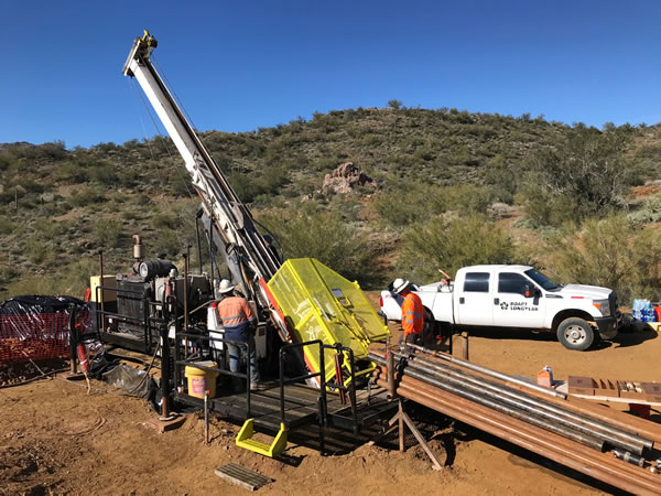
Recent drilling at the Kay mine deposit has focused mainly on stepout holes to probe the extent of mineralization.
Hole KM-22-97: 8.8 metres at 4.8% CuEq and 1.5 metres at 1.3% CuEq. Along the north edge about midway down the deposit, this hole extended mineralization approximately 100 metres north of hole KM-22-71A and confirmed the vertical continuity of high-grade mineralization in the 160 metres between holes KM-20-11 and KM-21-19.
Hole KM-22-98: Three intervals, including 4.6 metres at 0.8% CuEq and 4.3 metres at 0.9% CuEq. Drilled from pad 1 into the central upper part of the deposit, extending mineralization about 65 m upward into the gap between the upper north and upper south zones.
Hole KM-22-99: 9.6 metres at 0.6% CuEq and 3.0 metres at 0.9% CuEq. A step-out hole along the north edge of the deposit. Together with hole KM-22-97, this hole extends mineralization about 160 metres north of hole KM-22-71A in the upper-middle portion of the deposit.
Hole KM-22-63B: 1.5 metres at 0.5% CuEq; deep in the deposit, north of KM-22-63D.
Hole KM-22-94: Three intercepts, including 17.7 metres at 0.7% CuEq, 3.2 metres at 1.1% CuEq and 1.3 metres at 0.8% CuEq. This is a step-out hole deep in the deposit along the north edge, 33 metres north of hole KM-21-27 and 55 metres north of hole KM-22-57B.
Hole KM-22-94A: Several intercepts, including 10.4 metres at 1.2% CuEq and 3.4 metres at 2.1% CuEq. This hole wedged about 60 metres below KM-22-94 and proved continuity between that hole and hole KM-21-51B.
Kay North extension – Hole KM-22-80: Two intervals, including 5.6 metres at 0.9% CuEq and 3.0 metres at 0.5% CuEq; drilled from pad 6 to the east, north of the main Kay mine deposit. These intercepts are deep within the footwall of the deposit and are the easternmost intercepts. This suggests either potential for other deeper horizons or possible complex folding.
Hole KM-22-91: 1.8 metres at 1.1% CuEq; drilled from pad 6 to the east and extends mineralization about 150 metres north of KM-22-87, which is located along the northern edge of drilled mineralization.
Central target – Hole KM-22-95: 2.7 metres at 0.5% CuEq from 432.8 metres down hole. This is a mineralized intercept in a new area (600 metres along strike north from the north end of the central EM anomaly and 500 metres west of the other drill intercepts in the pad 4 area); drilled northwest from pad 4 to test a strong soil anomaly. The mineralization is relatively zinc rich (0.22 per cent copper, 0.12 g/t gold, 0.61% zinc) and is clearly distal. It lies about 10 metres to 20 metres down hole of and stratigraphically below the mafic-felsic contact on the east limb of the central anticline. This interval shows mineralization along the prospective horizon far from any other known mineralization.
With the assayed holes released today, the company has completed a total of 79,600 metres at the Kay mine project since the inception of drilling. The company is fully financed to complete the remaining 3,800 metres planned for the phase 2 program with the priority focus areas for upcoming drilling as well as an additional 76,000 metres currently planned for the upcoming phase 3 program.
Arizona Metals owns 100% of the Kay mine property in Yavapai County, which is located on a combination of patented and Bureau of Land Management claims totalling 1,300 acres that are not subject to any royalties.