
Trailbreaker completes first diamond drilling at Liberty copper property, British Columbia
Trailbreaker Resources Ltd. [TSXV-TBK; OTC-APRAF] reported the completion of their first-pass diamond drill program focusing on the copper-molybdenum (Cu-Mo) porphyry target at its 100%-owned Liberty property in central British Columbia.
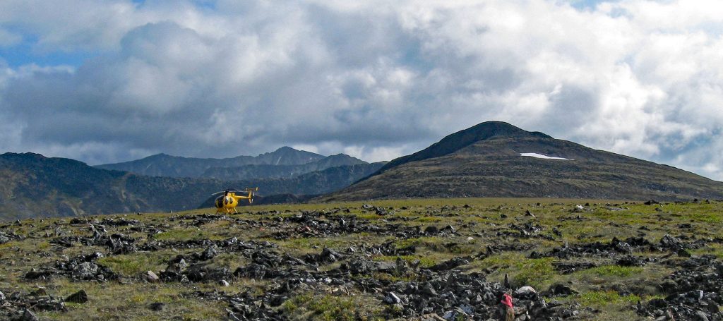
The program comprised 2,442 metres of diamond drilling in seven holes, ranging from 183 metres to 505 metres of depth. Permitting conditions constrained drilling to existing areas of disturbance over the target. Drill core is being logged, sampled, and prepared for analysis.
The drill program was focused on testing a copper-molybdenum ± gold ± silver (Cu-Mo ± Au ± Ag) geochemical soil anomaly1 coincident with an induced polarization (IP) chargeability and resistivity anomaly. A historic drillhole by Rio Tinto returned an interval of 123.1 metres grading 0.11% Cu and 0.04% MoS2 from surface to end of hole.
This hole is located approximately 300 metres directly south of the geophysical and geochemical targets that were the focus of the 2024 drill program. The historic drill hole is interpreted by the company as collared at the margin of a mineralized porphyry body. Reprocessing and 3D inversion imaging of the historic IP data were completed earlier this year and were heavily utilized in the drill planning process.
A soil sample orientation survey was conducted over the historic Mobile Metal Ion (MMI) soil anomaly. Soil material was collected for field-based portable X-ray florescence (pXRF) and traditional ICP-MS analysis with aqua regia digestion. A second sample was collected at each site for MMI analysis. The purpose of this orientation survey is to determine the most efficient and effective sampling
“This was a well-executed drill program that provided great coverage of our target area while maintaining a low-impact environmental footprint. The drill program exceeded the planned meterage and stayed under budget. I would like to thank our drill contractor, Dorado Drilling, for helping achieve our goals at the Liberty property,” commented Daithi Mac Gearailt, president.
The 5,054-hectare Liberty property is located approximately 60 km northwest of Quesnel, BC. The property is fully accessible by resource roads.
The primary target of the Liberty project is a northwest-trending Cu-Mo ± Au ± Ag MMI soil anomaly1. This overlaps an IP chargeability1 feature on the margin of the granitic intrusion. A historic drill hole to the south of this coincident anomaly returned an interval of 123.1 metres of 0.11% Cu and 0.04% MoS2.
In addition to the Cu-Mo porphyry target and the Cu-skarn target, which returned assay values of >8.0% Cu from historic trenching2, the expanded property also covers an epithermal gold target, where epithermal vein textures have been observed in a road cut2. Nearby soil and test pit samples returned anomalous grades of gold and arsenic. These may represent a lower-temperature epithermal portion of the hydrothermal system.