
Viscount Mining drills 1,778.5 g/t silver over 20 feet at Silver Cliff
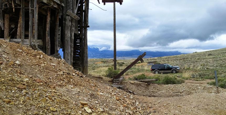
Viscount Mining's Silver Cliff property located 44 miles WSW of Pueblo, Colorado. Source: Viscount Mining Corp.

Viscount Mining Corp. [TSXV-VML; OTCQB-VLMGF] reported the first drill results from the Silver Cliff property in the Hardscrabble Silver District of Custer County, Colorado. The 2016 drill program that Viscount began in mid-November with its primary objective confirmation of historical drilling and mineral resource documentation on one of the Silver Cliff deposits known as the Kate Silver Resource (KSR). Nine holes with a total of 1,502 feet (457.8 metres) were completed as part of the drill program and this release is reporting values from K16-01, which was the first hole drilled and assayed at ALS Canada Ltd., at their laboratories in Reno, Nevada, and Vancouver, BC.
Assay results for confirmation hole K16-01 drilled at an inclination of -60° averaged 1,778 g/t silver (57.2 oz/ton) over 20 feet (6.1 m) from 60 to 80 ft. (18.3 to 24.4 m) of core interval. Each analyzed sample in this interval represented 5 ft. (1.52 m). The 50 ft. (15.24 m) of mineralized core from 55 to 105 feet (16.76 to 32.00 m) averaged 837.35 g/t silver (26.92 oz/ton). The collar of K16-01is estimated from historic maps and field evidence to be within 4 ft. (1.2 m) of historical drill hole DDH 73-2 for which reports show 1,927.7 g/t silver over 13.5 m (62 oz/t over 44.29 ft.).
Based on core logging, the mineralization is associated with silica which has replaced locally vuggy limestone of a reef comprised of fossilized stromatolites. Viscount’s technical team attributes the difference in silver values between 2016 drill hole K16-01 and historical drill hole DDH73-2 to the fact that such replacement typically is not uniform. The mineralized siliceous zone intersected by K16-01 is located at a depth from which it could be mined efficiently utilizing open pit techniques, and, because the reef appears to be nearly flat-lying, there is potential for lateral extensions of the mineralization.
Kaare Foy, Viscount Chairman, stated, “We are extremely pleased with the early results of our 2016 drill campaign at Silver Cliff. The high silver values represent a solid starting point toward addressing our primary goal for Silver Cliff which is to confirm the historical mineral resource and then look to enlarge that resource by extending the drill program outside the perimeter of the original resource on which the PEA was done by Tenneco. Today’s release represents a solid cornerstone for this mission and we look forward to reporting further assays from this program as they become available.”
Jim Ebisch, Viscount’s Project Manager for the 2016 drill program, further stated that: “Even given the fact that there is a historical silver resource and PEA completed for the Silver Cliff project, we believe the region containing, and immediately surrounding the KSR is materially underexplored and the historical resource there could be greatly enhanced in the future with just a few strategically placed drill holes. The 2016 drilling shows that the silver mineralization (blue-grey mineralization) is hosted predominantly by a gently-dipping, silicified carbonate reef that formed during a volcanic hiatus. The KSR at this juncture appears to be the result of simple carbonate replacement by silica-rich, silver/lead/zinc-bearing fluids adjacent to interpreted deep seated epithermal veins. These carbonate rock systems replaced by silicification-associated resources are commonly found over large lateral extents and the greatest promise for the KSR may eventually lie in undiscovered stacked horizons, in combination with high-grade epithermal veins that may underlie the KSR.”
Future exploration work at Silver Cliff’s KSR region will depend on the evaluation of the current confirmatory drill program once all of the assay results have been received and interpreted by Viscount’s technical team.
The Silver Cliff property consists of 96 lode claims where high-grade silver, gold and base metal production came from numerous mines during the period 1878 to 1894. It is located 44 miles WSW of Pueblo, Colorado, and has year-around access by paved road. The property underwent substantial exploration between 1967 and 1984. The major explorers were Freeport, Hecla, Homestake, Moly Corp, Coca Mines and Tenneco Minerals.
The Silver Cliff Property is interpreted to encompass a large caldera and porphyry system which offers potential to host a number of deposits from both precious metals to base metals. This has been demonstrated in the mineralogy and grade historically extracted from numerous underground mining operations dating back to the late 1800s and early 1900s.
Drilling in the 1980s by Tenneco resulted in a historical pre-feasibility study which formed the company’s decision to put the property into production. Known historical silver grades range from below detection to a high of 2,125 g/t (68 oz/ton) silver over 13.4 metres. Known historical gold grades range from below detection to a high of 9.06 g/t (0.29 o/t) gold over 1.2 metres. Plans were halted due to the restructuring of Tenneco after it was sold.