
West Point Gold outlines new gold zone at Gold Chain Project, Arizona
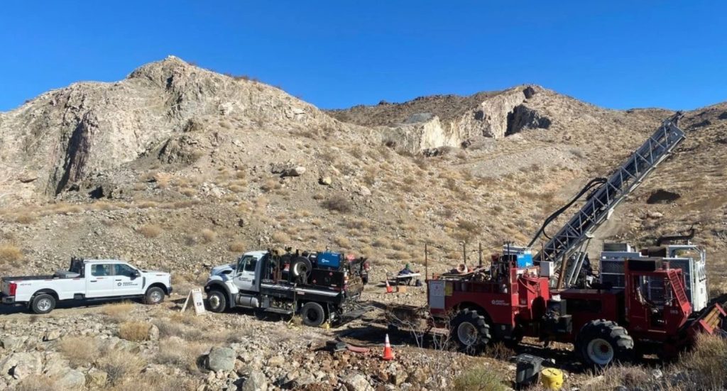
West Point Gold Corp. [TSXV: WPG; OTCQB: WPGCF; FSE: LRA0] reported the intersection of shallow gold mineralization at the Black Dyke target located 4 km west of the Tyro Main Zone, at the company’s Gold Chain Project, Arizona. The initial six reverse circulation (RC) drill holes at Black Dyke, suggest it is a highly prospective area where additional resources could be defined at the Gold Chain Project.
Recent drilling results from the Black Dyke prospect have further prioritized the target for follow-up drilling in early 2026. To date, 10,255 metres of the ongoing 15,000-metre drill program at the Gold Chain project have been completed. Results are pending for 24 holes representing 5,361 metres from the Tyro Main Zone, South Tyro, Sheep Trail, and Bull 8 targets.
Highlights: Black Dyke hosts a shallow-dipping body of quartz veinlets and breccia ranging in estimated thickness between 7.6 and 36.6 metres over a strike length of at least 200 metres and from surface to approximately 250 metres down-dip.
The zone remains open along strike to the west and down-dip to the southwest. Alteration and textures observed in near surface drill results suggest the presence of a potentially deeper gold system associated with this shallow mineralization.
Four km west of Tyro, Black Dyke now represents a second area for potential resource development; follow-up drilling is planned to expand the limits of the shallow oxidized gold mineralization
“Black Dyke is now a potential second resource development area at Gold Chain, which is a meaningful milestone for the project. Shallow, oxidized gold from the surface, with the zone open in multiple directions, gives us a well-defined path to expand this target. Equally compelling is that West Point Gold found this by applying modern methods to a historically underexplored prospect, and the company is taking that same approach across the property. With results pending from multiple step-out targets, it appears that the potential of the Gold Chain Project is still being defined,” stated Derek Macpherson, President and CEO.
Holes GC26-95 and GC26-97 through GC26-101 confirm the presence of gold in the subsurface over meaningful grades and widths. The mineralized zone is part of the historical Black Dyke structure and confirms the presence of gold identified in previous exploration efforts. Figure 3 provides a preliminary view of this newly drilled zone and reveals that the gold-bearing holes cut the surface breccia a short distance, up to 250 metres, down-dip. A short distance into the hanging wall, volcanic rocks deposited upon the Precambrian granite are strongly altered (kaolinite-silica-iron oxide) and brecciated.
Hole GC26-95 contains 36.6 metres of 1.04 g/t Au and GC26-98 intersected 21.3 metres of 0.92 g/t Au. It appears that the holes closest to the intersection of the Black Dyke breccia and the suspected NE-trending structure are thicker and point to the importance of this structural intersection. The southward continuation of this mineralized zone is likely and supported by the projection of mineralized, regional structures (Roadside Mine fault) and hydrothermal alteration in the overlying volcanics.
West Point Gold plans to return to the area to expand the gold zone by drilling to depth and laterally. The gold-bearing vein occurs as fragments in a calcite-cemented breccia. It is anticipated that these fragments emanated from a discrete vein or breccia body at depth.
The northern limit of the Black Dyke prospect is defined by a northwest-trending low-lying ridge composed of coarsely crystalline calcite cementing up to 80+% chalcedony vein and vein (hydrothermal) breccia. The calcite is commonly banded and can be correlated to other calcite veins across the Gold Chain project, which are considered to have been deposited late in the gold system’s history and after the gold events.
Historical reports and mapping suggested a southward dip between 30 and 60 degrees. Drilling now indicates a shallow, southerly dip of less than 30 degrees. The western and eastern limits of the low-angle breccia are defined by north- to northeast-trending faults. In the surface exposures both the footwall (FW) and hangingwall (HW) rocks are composed of Precambrian granite. The FW contact is sharp with weak propylitic alteration in the underlying Precambrian rocks. The HW is strongly replaced by chlorite and invaded by abundant low-angle calcite veins (<1m) and veinlets. Surface weathering, which extends down to the footwall contact, is evidenced by strong iron and manganese oxides in the gold-bearing zones. Gold mineralization in these initial holes is associated with quartz-chalcedony-calcite veinlets, vein and vein breccia.
This entire south-dipping package passes beneath intensely altered (kaolinite-silica-iron oxides) Miocene dikes and volcanic breccias and tuffs. These rocks comprise distinct low-lying hills surrounded by alluvial deposits composed of gravel and sand. It is suspected that this high-level alteration is related to the gold events operative at Black Dyke.
The Black Dyke mine, which consists of a backfilled shaft, several small pits and dumps, and extensive roads, is located 4.8km east of the Katherine mine and 4.0km west of the Tyro Main Zone. The Katherine vein, like the Tyro vein (West Point Gold), trends northeast and consists of a broad zone of sub-parallel quartz-chalcedony-adularia-calcite veins and veinlets developed along ancestral shears and Miocene rhyolite dikes. Shortly after the discovery of the Katherine vein in 1900, prospectors discovered a broad, easterly trending gold-bearing ridge referred to as a “dyke”. It was later described as a vein breccia, up to 30 metres wide, composed of broken chalcedony vein and breccia cemented by a massive to banded, coarsely crystalline gray calcite with elevated manganese. Weathering of the siliceous vein fragments resulted in a dark patina (desert varnish) and, hence, the Black Dyke (dike).
There is no reported gold production from the Black Dyke mine although a two-compartment shaft was open in 1940 which was sunk to 150 feet (45.7m) in the hanging wall of the south-dipping breccia complex. Several hundred feet of drifting was conducted from the bottom of the shaft with much of it reported to be in mineralized rock. Historical assays reveal low gold grades over broad widths up to 30 metres. Intermittent exploration and development activities continued up through the 1930s but without recorded production.
In the 1980s, several RC/rotary drilling campaigns were conducted with up to 12 holes drilled across the prospect. One hole, RSM15, drilled 20m of 0.65 g/t Au at 41 metres. Aside from these few holes, there does not appear to have been additional exploration until West Point Gold optioned the property in 2019.
West Point Gold is an exploration and development company focused on unlocking value across four strategically located projects along the prolific Walker Lane Trend in Nevada and Arizona, USA. The company’s near-term priority is advancing its flagship Gold Chain Project in Arizona.
Resource World Magazine Inc. has prepared this editorial for general information purposes only and should not be considered a solicitation to buy or sell securities in the companies discussed herein. The information provided has been derived from sources believed to be reliable but cannot be guaranteed. This editorial does not take into account the readers investment criteria, investment expertise, financial condition, or financial goals of individual recipients and other concerns such as jurisdictional and/or legal restrictions that may exist for certain persons. Recipients should rely on their own due diligence and seek their own professional advice before investing.