
West Point Gold drills 56.4 metres of 4.24 g/t gold at Gold Chain Project, Arizona
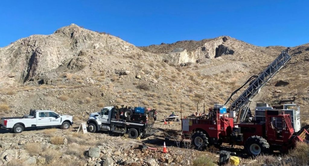
West Point Gold Corp. [TSXV: WPG; OTCQX: WPGCF; FSE: LRA0] reported results from two drill holes within the high-grade Northeast (NE) Tyro zone at its flagship Gold Chain Project in Arizona. Hole GC26-168 was a reverse circulation (RC) hole that intersected 56.4 metres of 4.24 g/t gold from 242.3 metres, including 28.9 metres at 7.77 g/t gold.
This hole was drilled as a follow-up to GC26-161, which was a core hole that intersected 68.2 metres at 2.20 g/t Au from 210.5 metres, including 34.3 metres at 3.57 g/t Au. These holes continue to extend the zone at NE Tyro down-dip where it remains open to depth. The previously released hole GC26-148 suggests that the zone appears to be widening at depth.
The company is reporting assay results for two drill holes (628.5m), GC26-161 and GC26-168. Results from 19 holes representing 5,920m of the recently completed 21,079-metre program are still pending. All results from Tyro Main and NE Tyro are expected to contribute to the company’s upcoming maiden resource estimate to be released later in 2026.
Highlights: Hole GC26-168 (RC), drilled about 20m below GC26-161, returned 56.4 metres of 4.24 g/t Au from 242.3 to 298.7 metres, including 28.9 metres at 7.77 g/t Au. The TW is estimated to be 28 metres.
Hole GC26-161 (core) was drilled across the NE Tyro vein zone about 230 metres down-dip from surface and intersected 68.2m at 2.20 g/t Au from 210.5 to 278.7 metres including 34.3 metres at 3.57 g/t Au. The true width (TW) is estimated to be 40 metres.
Deep drilling across the Tyro NE zone suggests that the vein system widens and extends 270 metres below the surface where it remains open in all directions.
“With these results and GC26-148, the apparent widening, along with the textures observed, suggests multiple gold mineralizing events with deposition over a greater vertical range than you would typically see in low sulphidation epithermal systems. These results further support the zone remaining open to depth,””stated Derek Macpherson, President and CEO.
All widths shown are downhole; true widths are approximately 50-60% of downhole widths.
Both Holes GC26-161 (core) and -168 (RC) targeted the down-dip extension of the NE Tyro zone and crossed the vein system between holes GC26-148 (66.2m at 6.57 g/t Au) and GC26-157 (31m at 3.4 g/t Au) at an elevation of about 600 metres above sea level (ASL) which is 250 metres below surface. Both holes deviated somewhat to the south resulting in a step-out of only about 30 metres from GC26-148.
The proximity of the two holes allows for a comparison between the two drilling/sampling techniques. It was also deemed important to cross higher-grade portions with core where detailed documentation of recovery, RQD, vein styles, textures and density has occurred. In summary, these two holes support the emerging geologic (Figure 3) and grade models and improve the definition of the high-grade gold mineralization in the NE Tyro zone at the Gold Chain Project. The two holes comprising this release represent 628.5m of the now completed 21,079-metre drill program.
Both holes corroborate the widening of the vein system observed to the south in hole GC26-148. The primary structural control appears to define the footwall (FW) contact where a broad, and generally high-grade, hydrothermal breccia is in sharp contact with the hosting Precambrian granite. The intensity of vein-filling (quartz-calcite-adularia) diminishes upwards toward the hanging wall (HW) along with a general decrease in gold grades. The vein system may be steeping at an elevation of about 650 metres ASL (200m below surface), which may explain the widening of the ‘damage zone’ and associated fracturing.
Hole GC26-161 encountered mineralization between 201.5 and 278.7 metres containing 2.20 g/t Au within a broad envelope of fractured, broken and altered granite. This envelope contains 34.3 metres at 3.57 g/t Au from 244.5 metres in a zone of quartz-chalcedony-calcite adularia stockwork and breccia. Hole GC26-168 encountered similar mineralization at a slightly greater depth from 242.3 to 298.7 metres (56.4m) at 4.24 g/t Au, containing 28.9 metres at 7.77 g/t Au from 269.8 metres down to the FW contact.
The vein system along this section dips 75 degrees where it steepens to near-vertical at about 650 metres ASL (200m below surface). The intercept has developed around a couple of fine-grained intrusive phases, i.e. dikes, that are strongly altered, broken and veined. This spatial coincidence may reflect a preference for the gold-bearing fluids to follow the dikes (more brittle) and/or the contact with the hosting Precambrian (likely broken and faulted). The modelling of these features in the upcoming weeks will provide greater insight into deeper targets.
The main mineralized zone or “vein breccia” in GC26-161 hosts most of the gold mineralization. Veins and breccia composing the NE Tyro vein are multi-stage and comprised of quartz-chalcedony-calcite (bladed)-adularia with only trace amounts of pyrite. Bladed calcite or “lattice texture” has developed in several stages and ranges from delicate bands within crustiform/coliform-banded chalcedony to coarse, angular fragments in late-stage breccia.
West Point Gold is an exploration and development company focused on unlocking value across four strategically located projects along the prolific Walker Lane Trend in Nevada and Arizona, USA. The company’s near-term priority is advancing its flagship Gold Chain Project in Arizona.